Staying Vigilant On and Beneath the Waterline
The ocean is a very large and increasingly congested place. More and more shipping and industry is using it. But the risks hidden below the waterline, that established navigational tools don’t always detect, remain.
But what if the trend for new surface-based sensor technology, the likes of which enable cars to detect potential collision hazards, could be available for shipping to detect underwater obstacles?
That’s just what Sonardyne International Ltd. has developed with its new Vigilant forward looking sonar (FLS). Instead of a visual parking aid, which shows you the view behind your car as you reverse, Vigilant builds a live, easy to interpret 3D terrain map of the seabed and the water column ahead, out to 600 meters and down to 100 meters water depth. That de-risks navigating in unknown, dynamic or congested waters. It even makes finding an anchorage easier and, as the data is also stored, backing out of a confined area is made easier.
Vigilant also sends automated warnings when a submerged or semi-submerged object or obstacle – which could be otherwise hidden from sight, radar or Lidar – is detected in the water column, out to 1.5 kilometers ahead, which provides ample time to take avoidance action. Automated warnings can also be set for water depth, for those unexpected sand banks, reefs or even wrecks.
Derek Lynch, Global Business Manager for Marine Vessel Systems at Sonardyne, says, “It’s a powerful tool, taking the risk out of day-to-day operations as well as the more ‘off-chart’ navigation by the adventurous mariners among us. It’s also a marine autonomy enabler. All the outputs from Vigilant can be used by third party integrators and unmanned surface vessel (USV) operators, straight out of the box, providing these systems with that additional level of situational awareness.”
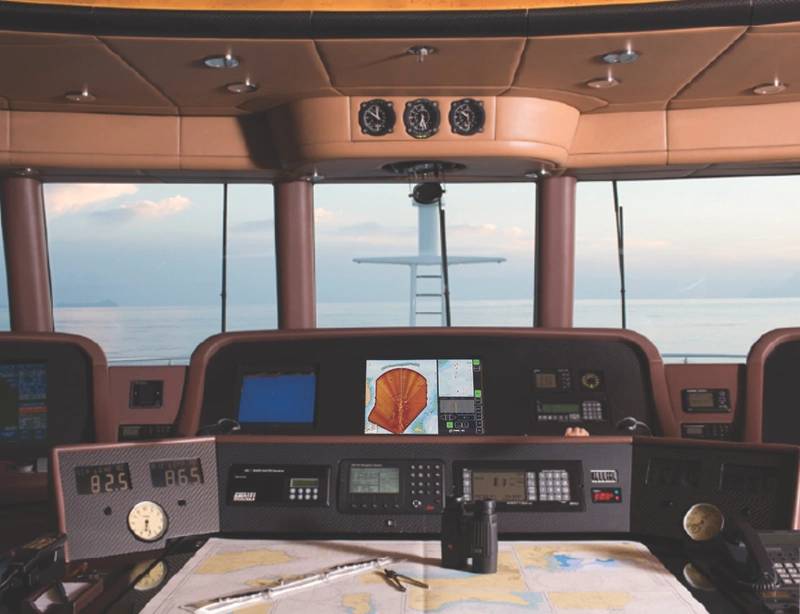 Vigilant installed on a ship’s bridge provides marines with obstacle avoidance and underwater awareness in dynamic or uncharted environments. (Photo: Sonardyne)
A lot of focused work has gone into both Vigilant’s hardware and how the sonar works to make it as compact as possible, explains Pete Tomlinson, Engineering Manager at Sonardyne. At 30 centimeters wide and weighing only 14 kilograms in air, it’s easier to fit, not just in newbuilds, where it’s relatively easy to design in a hull-mounted sensor, but also retrofits, from private yachts to military vessels, tankers and even cruise ships.
Vigilant works by transmitting acoustic energy into the water, through a 90-degree azimuth and through a vertical plane down to 100 meters water depth – deeper than any other system in the market. It then listens for the sonar returns.
These are used to power two principal operational modes, Depth mode and Sonar mode. Depth mode produces the detailed 3D color coded bathymetry, out to 600 meters and down to 100 meters water depth, using a proprietary Altitude Confidence Filter (ACF), which results in very stable, high integrity imagery. Sonar mode processes the intensity of the acoustic data to extract long-range positional data out to 1.5 kilometers and over a 90-degree field of view. In this mode, the sonar returns are used to generate computer aided detection (CAD) markers, which alert the operator (or a third-party artificial intelligence based processor) to the presence of navigationally relevant obstacles, such as coral reefs, rocks, containers or even small ice bergs.
“Multi-beam echo sounders (MBES) are a common type of sonar which seek to map the water column and seabed topography with a fan of beams projected directly beneath the host platform,” explains Rob Crook, Research Director at sister company Wavefront Systems Ltd., which developed much of the intelligence built into Vigilant. “In terms of the nature of the resulting imagery – maps of the seafloor and water column objects – this seems rather similar to what we have designed Vigilant to deliver. However, whereas MBES has the luxury of mapping directly beneath the host platform, achieving the fundamental operational requirement of an FLS means delivering the same type of information many hundreds of meters ahead of the host platform, often in shallow water. We need to ‘forward look’ and still provide navigationally relevant terrain and object detection data. That’s not easy.
“It means imaging both the surface and the seafloor and anything in-between (two highly reflective surfaces). It means handling high levels of multipath interference caused by multiple reflections off these two interfaces. We have to deal with increased levels of ray-bending, associated with propagation through a predominantly horizontal sound channel. We also need to process and select for real-time display a single meaningful cut through the dense 3D data point cloud of returns. Finally, the imagery has to be electronically stabilized against significant platform motion. With Vigilant, we’ve overcome these challenges and built the most capable (longest range, highest area coverage, highest resolution), commercially available forward looking sonar on the market.”
 Vigilant graphic user interfaces, in 3D mode and Sonar mode. (Images: Sonardyne)
During testing, throughout last year, Vigilant was put through some pretty rough and hostile acoustic conditions. It still picked out marker buoys, at more than 1 kilometers away, in Sonar mode. In 3D mode, it produced fantastic images in quite enclosed harbors; a space that’s about as challenging as you can get for sonar, says Tomlinson.
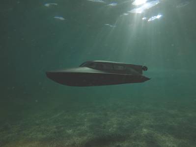
For the user, there’s a simple to interpret graphical user interface (GUI) with easy to use automatic obstacle detection and classification. The Vigilant displays have been designed to be clear and informative without the need for advanced sonar interpretation skills, and if required, users can also view the raw profile data showing the entire water column, so they can see how deep an object is. If it’s something shallow, for example, navy divers in a swimmer delivery vehicle, using Vigilant, would know they could pass beneath it.
It’s an ideal tool for those working in busy coastal waters, adds Tomlinson, where groundings are all too common. Offshore energy and commercial fishing operations, which often take place in busy and frequently shallow waters, would benefit too, as would vessels called upon for disaster relief operations, where they can be going in literally blind following a tsunami, earthquake or hurricane that has dramatically changed what may have previously been well charted seabed. “For naval operations, with Vigilant, operatives can be prepared for the unexpected, whether they’re in a swimmer delivery vehicle (SDV), or on a coastal patrol vessel or cruiser,” he says.


