HYPACK Barge Management System
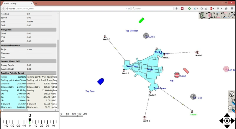
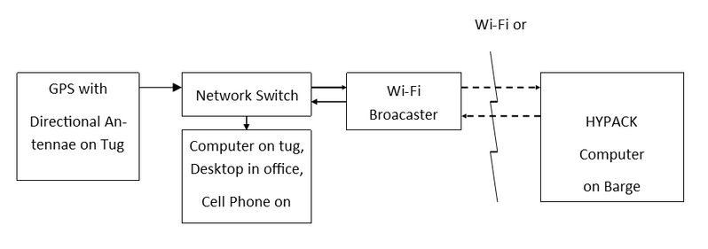
HYPACK offers a solution to track multiple vessels and share the information across vessels. It also allows any remote viewer with a web browser to observe the survey or construction operations on their PC, tablet or cell phone. Secondary vessels (tugs) are equipped with a Wi-Fi broadcaster which takes their network GPS feed and sends the messages to the Primary vessel (barge). Optional antennas can increase the range from 2km to over 10km.
Tugs can then receive their own Area Map showing all vessels using a Web Browser, or have additional controls for anchor handling and targeting by having their own HYPACK SURVEY license.
Using the HYPACK-supplied hardware, the GPS position from each secondary vessel is broadcast via a Wi-Fi network, making their position and heading data available to the barge computer. Long range antennae options allow for connections up to 2 miles between vessels. The HYPACK SURVEY computer on the barge positions all vessels on the user-defined projection with S-57 maps, GeoTIFs and construction drawings in the background. Tugs and remote viewers can then view their own survey screen, using either a web browser or their own copy of HYPACK. Users also get access to HYPACK’s support staff. Using TeamViewer they can log onto your remote computer, check the configuration and offsets and get back to operation.
www.hypack.com
(As published in the July 2015 edition of Maritime Reporter & Engineering News - http://magazines.marinelink.com/Magazines/MaritimeReporter)


