Arctic Marine Survey Work: NOAA & Coastguard Join Hands
With 3.4 million square nautical miles of U.S. waters to survey and chart, Coast Survey is up against some big challenges in keeping nautical charts current, consequently NOAA joins hands with the US Coast Guard to provide the best possible safety service to shipping.
With the Alaskan coast comprising 57% of the U.S. navigationally significant waters, a multi-agency partnership for hydro survey data is necessary for maritime safety.
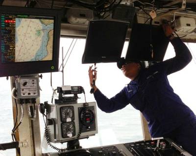
Since 2008, NOAA has been working with the U.S. Coast Guard in Alaska to improve shipping safety. For instance, the Coast Guard buoy tenders were finding that some of the natural channels moved from year to year, and so they started using single beam sonar to find the channels. Seeing a way to support this effort, NOAA experts joined U.S. Coast Guard buoy tenders as they headed into the Bering Sea, helping to train Coast Guard personnel to set the buoys safely, quickly, and accurately.
NOAA also started exploring the possibility of the Coast Guard collecting hydrographic data for nautical charts. In 2012, Lt. Cmdr. Mark Blankenship was NOAA’s lead on a joint NOAA/USCG Arctic hydrographic project about the U.S. Coast Guard Cutter Hickory , helping to develop an operational procedure to get Coast Guard survey data to NOAA. This year, NOAA noted that professionalism, enthusiasm, and teamwork resulted in U.S. Coast Guard Cutter Spar providing Bechevin Bay data that will help guide its decision-making for survey priorities.
This year’s successful Spar survey is an important step and NOAA says it looks forward to continuing this work with their Coast Guard partners, adding that it hopes to expand the IOCM concept to other vessels that have survey capability in the Arctic.


