

UKHO Partners with Shom to Launch International S-100 Sea Trials Program

The UK Hydrographic Office (UKHO) has launched an international sea trials program in partnership with the French Hydrographic and Oceanographic Service (Shom). The joint program represents the most comprehensive test of S-100 data standards to date and will form part of the International Hydrographic Organization’s (IHO) coordinated test bed framework. Throughout the trials, the UKHO and Shom will collect evidence to inform safety and efficiency use cases, while providing guidance on the introduction of the S-100 data framework, which is set to underpin the future of maritime navigation.
Need a Survey? There’s a USV for That
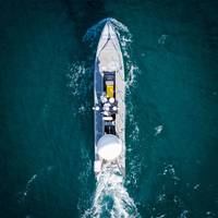
While the adoption of unmanned/uncrewed surfaces vessels (USVs) was initially in defence, use of these low footprint systems has spread into other sectors, not least survey, and now the race is on for greater capability, endurance and autonomy. Elaine Maslin reports.After starting small, in inland waterways, use of USVs for survey operations has moved into coastal and now offshore waters. Given the extensive amount of seabed and rapid growth in offshore wind, there’s plenty of work out there for them to do.With the travel restrictions posed by Covid and increasing awareness of climate change…
SBG Systems' INS Chosen for Shom Fleet
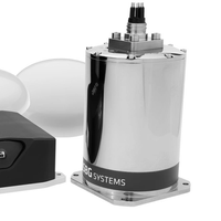
Shom, the French national hydrographic and oceanographic office selected SBG Systems’ inertial navigation sytems to renew their whole fleet of INS. They chose Navsight Apogee INS for their speedboats and survey vessels for both shallow and deep-water real-time bathymetric surveys and Qinertia PPK software for post-processing tasks.Shom has 3 major objectives: national hydrography and cartography, defense support in hydro-oceanographic fields, and support in maritime geospatial products and services for public policies on the sea and the coast.
Navigational Charts App Debuts at Ocean Business
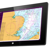
An independent consultancy and software development company will launch a new web and PC based navigational charting app at Ocean Business 2015. Norcom Technology Limited said its eChart software combines up to date information from different sources including wreck, cable, tide and geographical data for navigational charts, making it suited for use by companies carrying out desktop studies prior to installation of offshore structures, cables, pipelines and vessel monitoring.
UKHO Release Images of WWII D-Day Harbor

The UK Hydrographic Office (UKHO) has released stunning images from a survey of the underwater remains of an artificial harbor used in World War II that was used to facilitate rapid offloading of cargo onto the beaches during the Allied landings in Normandy. The images of Mulberry B, which was one of these portable temporary harbors developed and built in total secrecy by the British in World War II, have been created from a detailed 3D map that will allow archaeologists to assess the rate of deterioration of the remains.



