
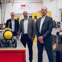
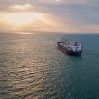
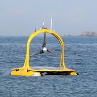
Fugro, Ocean Visions Team Up for Ocean-Based Carbon Removal Tech
Fugro has been selected by nonprofit organization Ocean Visions to lead the development of a standardized environmental impact assessment framework for marine carbon dioxide removal (mCDR), a set of emerging technologies that enhance the ocean’s natural ability to store carbon.The initiative aims to support the permitting of mCDR projects by providing a transparent, evidence-based approach to environmental review.The two-year project will involve designing, refining and testing…
Satellites Help NOC Track Tidal Change for Safer Port Operations
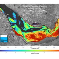
Scientists at the UK’s National Oceanography Centre (NOC) in Liverpool have used satellite data to create insight into the Mersey River that will help port operators be smarter about managing complex navigation channels. Through a project focused on Liverpool’s famous river and funded by the UK Space Agency, NOC’s scientists showed that changes in areas exposed at low tide can be mapped from space.The project, run in partnership with the Channel Coastal Observatory (CCO) and Peel Ports Group…
NOC: Natural Disasters Responsible for 25% of Subsea Cable Damage
A study led by the UK’s National Oceanography Centre (NOC) has found that natural hazards account for around a quarter of all recorded instances of subsea cable damage between 1965 and 2019, posing a threat to the growing infrastructure underpinning global connectivity.While human activities like fishing and anchoring remain the primary causes of damage, the study warns that climate change is intensifying many natural hazards, increasing risks to these vital networks.The threats…
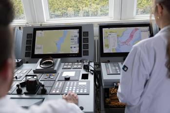
NOC and Royal Navy Renew MOU on Underwater Systems
The UK's National Oceanography Centre (NOC) has renewed a memorandum of understanding (MOU) with the Royal Navy, reinforcing a long-standing partnership in marine science and technology. The MOU, which includes collaboration with the Defense Science and Technology Laboratory (Dstl), the Ministry of Defense (MOD)’s science and technology organization, underscores a shared commitment to fostering innovation and advances in autonomous and robotic underwater systems.With expertise from NOC Innovations…
NOC Launches Innovation Hub to Power Ocean Tech and Blue Economy
The UK’s National Oceanography Centre (NOC) has unveiled a new Innovation Hub in Southampton, designed to accelerate advances in ocean technology and support sustainable growth across the blue economy. Backed by a £200,000 investment, the facility will serve as a catalyst for innovation in marine autonomous systems (MAS), the blue economy and beyond—bringing together researchers, businesses and entrepreneurs to drive progress across the ocean and maritime sectors.The new hub features state-of-the-art meeting…
Christmas @ Sea: “Seas and Greetings” from NOC
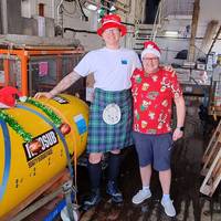
Have you ever wondered what happens on ships when they’re at sea for Christmas? Crews onboard the National Oceanography Centre’s (NOC’s) research vessels, based in Southampton, have given a glimpse into the holiday season out on the ocean waves, including Christmas carols and – if one captain has his way – watching Frozen.Both research ships that the center operates, the Royal Research Ship (RRS) James Cook and RRS Discovery, are out in the Atlantic Ocean over this Christmas period…
Navigating a Safe Future for Us and Our Marine Environment
Navigating our oceans safely is always at the center of our maritime operations, whether it’s while deploying instrumented moorings, weighing up to tens of tons and measuring multiple kilometers in length, or working in remote, ice-packed regions.World Maritime Day 2024 (September 26) – 50 years since the SOLAS convention was adopted – is reflecting on how we continue to navigate a safe maritime future. It’s a course we need to chart together, as an industry.As a research organization focused on understanding and protecting our ocean…
Cleaner Shipping Fuel is Contributing to Ocean Warming, Scientists Say
Shipping fuel regulations introduced in 2020 have led to a substantial cut in sulphur dioxide (SO2) pollution, but may also have made the ocean warmer by reducing cloud cover, according to a modelling study in a paper published late on Thursday.International Maritime Organization (IMO) rules to tackle marine pollution forced shippers to cut their fuel sulphur content to 0.5% from 3.5%, leading to an 80% decline in SO2 emissions, according to a research team led by Tianle Yuan at the University of Maryland.SO2…
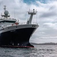
Babcock Wins £45 Million Contract to Maintain UK Research Vessels
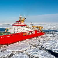
The U.K. has awarded Babcock International’s Rosyth shipyard a £45 million (approx. US$56.6 million) contract to maintain its fleet of three scientific research vessels.The initial three-year contract, announced by U.K. Industry and Maritime Minister Nusrat Ghani earlier this month, will see the large oceanographic and polar research vessels RRS Sir David Attenborough, RRS Discovery and RRS James Cook dock at Babcock’s state-of-the-art facilities in Rosyth, Scotland, for programmed maintenance and upgrade work.
Lloyd’s Register Foundation Names Boumphrey CEO

Lloyd’s Register Foundation announced the appointment of a new CEO to take the charity into its second decade.Dr. Ruth Boumphrey will take over from outgoing CEO Professor Richard Clegg following his retirement June 30, 2022. Professor Clegg was the charity’s first CEO and led the organization for 10 years.Dr. Boumphrey is currently Director of Research and Strategic Programs at Lloyd’s Register Foundation, the owner of Lloyd’s Register Group, where she leads its work on some…
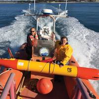
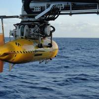
‘Boaty McBoatface’ Robotic Submarine to Visit End-of-life Oil and Gas Fields
The UK National Oceanography Centre (NOC) has secured funding from the UK Natural Environment Research Council (NERC), which will take robot submarine ‘Boaty McBoatface’ around end-of-life oil and gas fields. The Autonomous Techniques for infraStructure Ecological Assessment (AT-SEA) project, led by the NOC will trial the concept of using submarines like Boaty for high-tech, low-impact monitoring to pick up any potential environmental impacts at these sites, NOC said.The NOC has received £670…
SCIENCE: Seafloor Microplastic Hotspots Controlled by Deep-sea Currents
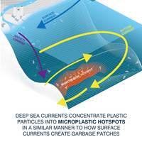
New research has revealed the highest levels of microplastic yet recorded on the seafloor, with up to 1.9 million pieces in an area of just one square metre.Published this week in the journal Science, this study shows how deep-sea currents act as conveyor belts, transporting tiny plastic fragments and fibers across the seafloor. These currents can concentrate microplastics within huge sediment accumulations, which the authors of the research term ‘microplastic hotspots’. These…
MBARI Works at Unlocking Ocean Biology
Greater understanding of what goes on in the ocean is starting to become a reality – thanks to growing use of unmanned surface and underwater vehicles and developments in biological sensing. Elaine Maslin takes a look at what a team at MBARI has been doing.Gathering biological data from the oceans remains a significant challenge for oceanographers. Now, an increasing range of unmanned vehicles that are able to work together is becoming available, as is an ability to collect biological data using them.It sounds straight forward…
BMT CEO Sarah Kenny Appointed OBE
BMT Group Ltd (previously British Maritime Technology) said that Sarah Kenny, Chief Executive of BMT has been appointed Officer of the Order of the British Empire (OBE) in the 2019 Queen's Birthday Honours.The accolade, for services to the Maritime Industry, and Diversity, reflects her long-standing commitment and contribution to supporting and promoting the United Kingdom’s maritime industries, in addition to her work on STEM and promoting the importance and value of diversity in the sector.Sir John Hood, Chairman of BMT Group, said: “On behalf of the board of BMT, may I say we are thrilled that our Chief Executive, Sarah Kenny, has been honoured by the Queen for her services to the Maritime Industries and Diversity.
UKHO Shares Marine Geospatial Data with Guyana
The UK Hydrographic Office (UKHO) has officially handed over marine geospatial data to the Guyanese Government after a campaign of hydrographic surveying.Delegates from the UKHO presented the data to government officials at a special event to celebrate the completion of the survey. Two workshops were held to brief ministers and provide technical support for applications of the data, which will help Guyana support the development of its marine economy.The data, which was collected over a period of four months between 2016 and 2017, will initially be used to update nautical charts of the Demerara River. This will enable ships to confidently reduce under-keel clearance and maximise cargo-carrying capacity…
Mappers Look to Chart World's Ocean Floor by 2030
Using data collected from underwater drones, merchant ships, fishing boats and even explorers, a new scientific project aims to map the ocean floor by 2030 and solve one of the world’s enduring mysteries.With 190 million square km (73 million square miles) of water - or about 93 percent of the world's oceans with a depth of over 200 meters (650 feet) - yet to be charted, the initiative is ambitious.Satinder Bindra, director of the Seabed 2030 project, said the work can be completed within the period and will shed light on everything from tsunami wave patterns to pollution…
How Sanchi's Spill Could Spread
The worst tanker oil spill in decades is unfolding across hundreds of miles of the East China Sea after an Iranian oil tanker carrying more than 100,000 tonnes of toxic oil collided with a freighter and exploded, killing all 32 crew onboard. The ship burned, spewing its cargo, for more than a week before sinking in the waters between China, Japan and South Korea. The Panama-registered Sanchi was carrying the equivalent of nearly 1 million barrels of ultra-light crude, plus its own fuel, to South Korea. According to the International Tanker Owners Pollution Federation, the collision led to the worst tanker spill in 35 years. Authorities have had trouble pinning down how big the spill is, as it changes by the day amid strong ocean currents.
The Impact of Future Global Tides on Energy
The first comprehensive study of the impact of global sea-level rise on tides has implications for future coastal flood risk, harbour management, and the long term planning of tidal energy sites. This research, published in Continental Shelf Research by scientists at the National Oceanography Centre (NOC), University of Southampton and Deltares, shows that sea-level rise can significantly alter tides across the world in many different ways in both space and time. The change will be most pronounced in shelf seas on the east coast of the Americas, northwest Europe, north coast of Russia, across Asia and Australasia. This study was conducted by feeding a range of ‘plausible’ estimates of global sea level rise…
Arctic Shipping Routes May Open by 2080 -NOC
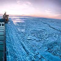
Commercial summer shipping across the North Pole may be possible by the end of the century, with the first potential crossings feasible for ice-strengthened ships around 2040. According to this study, by scientists at the National Oceanography Centre (NOC), Arctic shipping could potentially account for as much as 10 percent of all cargo transported between Europe and the Pacific. It will help supply communities and industries along the coasts of Siberia and Canada. A simulation…
Bleak Outlook for World's Oceans
Global warming will disrupt four-fifths of the world's oceans by 2050 if greenhouse gas emissions keep rising, Reuter's quoted scientists as saying. The situation is threatening fish that are the main source of food for a billion people. Curbs on man-made emissions, however, would give marine life more time to adapt to warming conditions or for marine life from algae to cod to shift to cooler waters nearer the poles, they said. "By 2050 around four-fifths of the ocean surface will be affected by ocean acidification and ocean warming," lead author Stephanie Henson, of the British National Oceanography Centre in Southampton, told Reuters of the findings. Carbon dioxide, the main greenhouse gas, forms a weak acid in water.
Unmanned Surface Vessels: From Concept to Service
Over the next decade the maritime sector is likely to see one of the largest changes since sail gave way to steam. Unmanned Surface Vehicles (USV) are now being considered for various marine roles and the drivers for rapid development are significant. Unmanned or autonomous vessels have passed through the trial and evaluation stage and are now being adopted for civilian and military applications. The maritime sector now has the opportunity to shape technology developments from legislative and end-user standpoints.
Autonomous Systems Competition Enters Final Phase
The final phase of a competition to develop novel adaptive autonomous ocean sampling network (AAOSN) management systems for the National Oceanography Centre (NOC) is now underway. Two UK consortia will move forward to develop systems capable of coordinating a suite of marine autonomous vehicles gathering data from the ocean over periods of months, and tracking and sampling dynamic features. The two-phase competition was launched last September by the Natural Environment Research Council (NERC) in partnership with the Defense Science and Technology Laboratory (DSTL) and Innovate UK…
Robots Help Map England’s Deepwater Canyons
The first true three-dimensional picture of submarine canyon habitats has been produced using a combination of marine robotics and ship-based measurements. The information captured in this new set of maps ranges in scale from the 200km canyon down to the size of an individual cold-water coral polyp, and will be used to inform the management of the only English Marine Conservation Zone in deep water. This ‘nested map’ is the result of a recent scientific expedition to the Whittard Canyon in the Bay of Biscay, led by the National Oceanography Centre (NOC).