Jacksonville Adds PORTS Real-time Data System
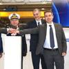
Officials from NOAA, the Jacksonville Marine Transportation Exchange, and the Jacksonville Port Authority officially dedicated a new information system today which will increase safety for ships using the St. Johns River.
The system, called Physical Oceanographic Real-Time System (PORTS), provides real-time information on water levels, currents, meteorological conditions, and under-bridge clearance, giving users critical information when traveling through the river. The St. Johns River in Jacksonville will become the 23rd location to use the system and is the second largest PORTS ever established.
“Our nation’s ports are critical cogs in our country’s economic engine,” said Kathryn D. Sullivan, Ph.D., under secretary of commerce for oceans and atmosphere and NOAA administrator. “NOAA's PORTS system gives shipping companies, captains, fishermen and others vital environmental intelligence that helps them navigate these waters more safely and efficiently. This is a win-win for the port, our partners, the surrounding communities and every business and industry that depends upon this flow of goods."
The Port of Jacksonville ranks as the number one vehicle export port in the nation and is the top container port in Florida. Approximately 65,000 people in northeast Florida have jobs directly or indirectly related to this port, and $19 billion gets channeled into the U.S. economy from this port every year.
“By providing integrated real-time tide, weather and bridge clearance information, Jacksonville PORTS will help reduce the chance of a ship accident,” said Richard Edwing, director of NOAA’s Center for Operational Oceanographic Products and Services (CO-OPS). “Economic benefit studies done at four PORTS locations around the U.S. have shown a 50 percent reduction in groundings and $50 million in economic efficiency benefits every year.”
Knowledge of the currents, water levels, winds and density of the water can enable shippers to optimize cargo loads so that vessel captains and pilots are using every inch of available channel depth safely, maximizing profits and efficiency.
"Jacksonville stakeholders have made a significant investment in the development of a comprehensive maritime domain awareness program,” said Jim McLaughlin, executive director of exchange, known as JMTX. “Jacksonville PORTS captures real-time hydrographic and meteorological data that, when used in conjunction with existing vessel tracking systems and radar, provides a complete operational picture of port activities.”
“The real time information provided by PORTS is invaluable to balancing JAXPORT’s dual priorities of enabling safe and efficient commerce while protecting the natural resources so critical to our quality of life in northeast Florida,” said Brian Taylor, CEO of the Jacksonville Port Authority. “We know this system makes us a more competitive port and will help us fulfill our mission of contributing to the region’s overall vibrancy.”
Tailored to the specific requirements of each seaport, PORTS is a decision support tool that improves the safety and efficiency of maritime commerce and enhances coastal resilience and natural resource management through the integration of real-time environmental observations, forecasts and other geospatial information.
In addition to providing useful information for maritime transportation and coastal resilience, the use of the water temperature and tidal data can be used by the fishing industry to improve catch, while recreational boating excursions can occur more often and be safer through better real-time information available through PORTS.
CO-OPS, as part of NOAA’s National Ocean Service, is an organization of experts in understanding tides, currents and water levels, turning operational oceanographic data into meaningful information, products and services for the nation. This coastal intelligence provides timely, applicable information, developed from reliable and authoritative science, to provide insight to decision makers into present and future conditions in the coastal zone.
NOAA’s mission is to understand and predict changes in the Earth's environment, from the depths of the ocean to the surface of the sun, and to conserve and manage our coastal and marine resources.


