U.S. Navy Responds to Increased Arctic Activity
The loss of seasonal sea ice in the Arctic will have ramifications for the U.S. Navy in terms of future missions, force structure, training and investments. To get a better handle on planning for future Arctic missions, Chief of Naval Operations (CNO) Adm. Jonathan Greenert asked me to provide an unambiguous assessment of how ice coverage will change in the Arctic and how human activity in the Arctic will change in response to decreased ice coverage and other factors.
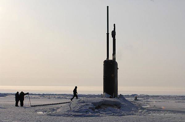
To understand this challenge, let me give you a little background. Thirty years ago, 35% of Arctic sea ice was two to four meters thick and did not significantly diminish during the summer melt season. This thick, hard multi-year ice restricted access to the Arctic Ocean, and made the region less than attractive to commercial interests, or surface security forces for that matter. Submarines were able to sail under the ice, and were the only naval vessels that routinely went to the high latitudes.
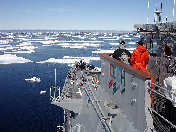
Today, much of the perennial ice is gone and the Arctic Ocean is covered with younger first-year ice that is thinner and more vulnerable to melt during the Arctic summer. This young ice is also easier to break, making the region even more accessible for ships with ice-strengthened hulls. First-year sea ice begins to melt in the Arctic in late March, with a minimum sea ice extent achieved annually in September. Sea ice then begins to accrue until it reaches a maximum in mid-March and the cycle repeats.
In September 2012, a record minimum was observed in which sea ice covered less than four million square kilometers of the total 14.1 million square kilometers that comprise the Arctic Ocean. While the September 2013 sea ice extent minimum was higher than 2012 at 5.3 million square kilometers, it was still significantly less than the thirty year observed mean of 6.27 million square kilometers and was the sixth lowest on record.
In response to the CNO’s tasking, we assembled an interagency team of Arctic experts from various Navy offices, the National Oceanic and Atmospheric Administration, the National Ice Center, the U.S. Coast Guard, and academia. As a final review of the team’s conclusions, a panel of national experts from the Naval Studies Board, a component of the National Research Council of the National Academies, validated the methodology and supported the team’s assessment.
The team reviewed the scientific literature on current Arctic sea-ice projections and agreed to use three scientific approaches described in an article published in the journal Geophysical Research Letters. (Overland, J. and M. Wang (2013), “When will the summer Arctic be nearly sea ice free?” (Geophys. Res. Lett., 40, 20972101, doi:10.1002/grl.50316).
To capture the intent of this assessment, we characterized sea ice in terms of its areal coverage and consequent impact on the availability of four sea passages associated with the Arctic. We also use the World Meteorological Organization’s metric “open water,” which is defined as up to 10% of sea ice concentration with no ice of land origin (e.g., icebergs). These waters are navigable by any open ocean vessel capable of operating in northern latitudes without ice breaker escort. Additionally, when considering “shoulder seasons,” period of time prior to and after open water periods, the team adopted sea ice concentration between 10%-40% of sea ice as its benchmark. This 40% figure corresponds with current depictions of the Marginal Ice Zone, available through sources such as the National/Naval Ice Center. Vessels operating during shoulder seasons will require at least minimal ice-hardening and will require icebreaker escort.
For the near-term, defined as present to 2020, current trends are expected to continue, with major waterways becoming increasingly open. By 2020, the Bering Strait (BS) is expected to see open water conditions approximately 160 days per year, with another 35 to 45 days of shoulder season. The Northern Sea Route (NSR) will experience around 30 days of open water conditions, also with up to 45 days of shoulder season conditions. Analysis suggests that the reliable navigability of other routes is limited in this timeframe.
The mid-term period, from 2020 to 2030, will see increasing levels of ice melt and increasingly open Arctic waters. By 2025, we predict that the BS will see up to 175 days of open water (with 50-60 days of shoulder season.) These figures increase to 190 days of open water (and up to 70 days of shoulder season) by 2030. For the NSR, we predict up to 45 days of open water (with 50-60 days of shoulder season) by 2025, increasing to 50-60 days of open water by 2030 (with up to 35 days of shoulder season conditions). This period will begin to see greater accessibility of the Trans-Polar Route (TPR), which is forecast to be open for up to 45 days annually, with 60-70 days of shoulder season. Reliable navigability of the Northwest Passage (NWP) remains limited in this timeframe. The limited depth and narrow passages within the NWP make it an extremely challenging transit route, even during total open water conditions.
In the far-term, beyond 2030, environmental conditions are expected to support even greater and more reliable maritime presence in the region. Major waterways are predicted to be consistently open for longer periods, with a significant increase in traffic over the summer months. The NSR and TPR should be navigable 130 days per year, with open water passage up to 75 days per year. By 2030, the NWP is still expected to be open for only brief periods.
This assessment establishes the timeframe in which the Navy will prepare for expected increased activity in the Arctic region, and informs the update to the Navy’s Arctic Roadmap, a strategic approach to Navy’s future engagement in this growing ocean which supports maritime strategic crossroads.
navylive.dodlive.mil


