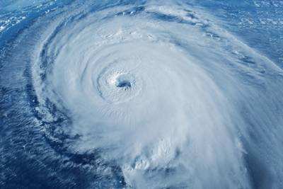
Where Are the Hurricanes? Quiet Atlantic Bucks Forecast for 'Super' Season
Forecasters earlier this year predicted that hurricane activity in the Atlantic Ocean could be supercharged in 2024. But the tropics have been abnormally quiet in recent weeks, often the busiest ones of the year.
The Atlantic hurricane season, which officially spans June 1 to Nov. 30, started on a strong note. In early July, Hurricane Beryl became the earliest observed Category 5 storm, the strongest rating, breaking the record by more than two weeks.
Next week marks the traditional peak of Atlantic hurricane season, but there has been no action of note in more than two weeks, leaving some scientists scratching their heads over this sudden void in tropical development.
The stage should have been perfectly set for a “super” season. Waters in the Atlantic Ocean have been extremely warm since last year, offering extra fuel to a developing storm.
Further, the mid-2024 transition away from El Nino was to be supportive. Upper-air wind patterns associated with El Nino, the warm phase of the equatorial Pacific Ocean, often hamper hurricane formation in the Atlantic Basin.
These ingredients led to the aggressive 2024 predictions from multiple forecasters who, on average, called for around 23 named tropical storms, some 11 of them reaching hurricane status. The long-term averages are 14.4 named storms and 7.2 hurricanes per year.
As of this week, this season has featured five named storms and three hurricanes, the latter of which is slightly ahead of average pace.
That advantage may slip as nothing is expected through at least the next several days, but storm activity could pick up again later this month.
Quiet times, explained
The often-unpredictable nature of the atmosphere is now on full display as the usually dominant factors, warm waters and the lack of El Nino, have been offset by other climatic forces.
One of the biggest hurricane-suppressors right now is the presence of drier-than-normal air near the west coast of Africa, where tropical disturbances form. Warm, moist air offers the optimal condition for storm development.
The reason for this dryness is not completely clear, but one idea is linked with the Indian Ocean’s version of El Nino/La Nina. That circulation unexpectedly fell out of a very warm phase mid-year, which may have ushered in the recent bout of dry air over the Atlantic.
Forecasters at Colorado State University this week offered another angle, basically explaining that waters in the area where Atlantic hurricanes form may have become too warm for their own good, as their interaction with cooler waters near the equator may have pushed the favorable, moist air mass too far north.
Not only are the waters extremely warm, but the upper atmosphere is also very warm. This acts to stabilize the atmosphere, but storm formation relies on instability, which arises when there is a sharp contrast in temperatures.
Guard still up
With nearly three months left in the season, the recent lull in hurricane activity is not cause for relaxation. CSU believes tropical conditions may turn more favorable for storm development around the middle of September, and an above-average Atlantic season could still be in the cards.
The equatorial Pacific Ocean in recent weeks has descended further toward La Nina territory, which could be supportive for later-season hurricanes.
The two most active hurricane seasons on record, 2020 and 2005, featured cool Pacific Ocean temperature anomalies similar to those currently in place. Storm development was very frequent between September and November in both of those years.
As of Thursday, the U.S. National Hurricane Center had identified five areas of disturbance in the Atlantic, more than would normally occur simultaneously.
Those are not forecast to produce much at all in the way of hurricanes, but it may be a sign that the ingredients are present and a flurry of storms could be ignited should the atmosphere decide it is ready.
(Reuters - Writing by Karen Braun, a market analyst for Reuters. Views expressed above are her own. Editing by Matthew Lewis)


