By Debra Colbert, Waterways Work!
In our fast-paced, contemporary world, it is sometimes hard to recall the historical origins of modern-day advances we take for granted. A good example is this country's inland waterways navigation system which allows for the transport of key commodities such as coal, grain, chemicals, and petroleum. And while our national waterways system today is a critical, integral component of the manufacturing, distribution and industrial economy of the United States and its ability to compete in world markets, its origin stems from a small river expedition of two young explorers, Meriwether Lewis and William Clark.
Then-President Thomas Jefferson, in planning the exploratory mission of Lewis and Clark, had a vision to find an all-water route across the continent to promote future trade, commerce, and expansion of the American nation. A primary objective was to find a practical transportation link across the continent and explore the Louisiana Territory.
The President also wanted information about the natural sciences and Indian cultures of the new West. Congress authorized the expedition in 1803, with combined purposes of scientific, geographical, commercial, agricultural, and ethnographic discovery for the new nation.
In explaining his reasoning to the Senate and House of Representatives in a confidential message dated January 1803, Jefferson expressed his desire for commercial expansion as well as his ideas for better assimilating Indian tribes into the country. If the sources of the rivers were nearby, Jefferson reasoned that American traders would have a superior transportation route to help them compete with British fur companies pressing southward from Canada.
While the statesman Jefferson had previously proposed serious expeditions of western exploration, his role as President was the strong impetus to move forward with Congressional authorization for this critical mission.
As the Lewis & Clark Trail Foundation, Inc., (www.lewisandclark.org) relays it:
On February 28, 1803, the Congress appropriated funds for a small U.S. Army unit to explore the Missouri and Columbia rivers and tell the western Indian tribes that trade with America would soon follow. The explorers were to make a detailed report on western geography, climate, plants and animals, and to study the customs and languages of the Indians. Plans for the expedition were almost complete when the President learned that France offered to sell all of Louisiana Territory to the United States. This transfer, which was completed within a year, doubled the area of the United States. It meant that Jefferson's Army expedition could travel all the way to the crest of the Rockies on American soil, no longer needing permission from the former French owners. Jefferson selected as leader for the exploring mission an Army captain, 28-year-old Meriwether Lewis. The Jeffersons and Lewises had been neighbors near Charlottesville, Virginia, where Lewis was born August 18, 1774. As a boy he had spent long hours tramping and hunting in the woods and acquiring a remarkable knowledge of native plants and animals. He served in the Virginia Militia when President Washington called it out in 1794 to quell the Whiskey Rebellion. Lewis was having a successful career in the regular army when the newly elected Jefferson summoned him in 1801 to work as his private secretary in the "President's House."
Lewis chose a former army comrade, 32-year-old William Clark, to be co-leader of the expedition. Clark was born August 1, 1770, in Caroline County, Virginia. At the age of 14, he moved with his family to Kentucky where they were among the earliest settlers. William Clark was the younger brother of General George Rogers Clark, a hero of the Revolutionary War. William served under General "Mad Anthony" Wayne during the Indian wars in the Northwest Territory.
Lewis and Clark reached their staging point at the confluence of the Mississippi and Missouri rivers near St. Louis in December 1803. They camped for the winter at the mouth of Wood River, on the Illinois side of the Mississippi, opposite the entrance to the Missouri River. The two captains recruited young frontiersmen and enlisted soldiers who volunteered from nearby army outposts. Over the winter final selections were made of proven men. In the spring, the expedition's roster comprised approximately 45 including some military personnel and local boatmen who would go only part way. Lewis recorded that the mouth of Wood River was "to be considered the point of departure" for the westward journey.
The rest is, as they say, history. Today, our nation's valuable waterways transportation system accomplishes the goals President Jefferson had in mind, and the Ohio River is a key factor in our nation's freight transportation network.
Even earlier than Lewis & Clark, George Washington was among the first to suggest improved navigation of the Ohio River and its tributaries. Just after the American Revolution ended, Washington developed a map showing routes of proposed roads and canals to connect the eastern and western waters. Later, a definite plan for the improvement of the Ohio and its chief tributaries was proposed by General Richard Butler, with the use of dikes and dams to deepen channels and make them more navigable. Later, neighboring states of Pennsylvania, Virginia, Ohio and Kentucky recommended the construction of a canal around the Falls at Louisville and generally improve the condition of the Ohio River.
The Mississippi and Missouri rivers were similarly developed, along with the more than 12,000 miles of the modern, commercially active portion of our national inland waterways system. Now bordering more than 38 states, America's rivers clearly were - and are -- the main thoroughfare of commerce, just as Jefferson had anticipated.
Today, the movement of commerce on our nation's rivers offers myriad benefits and benefits American consumers from the prices of products and services allowed by low-cost U.S. waterways transportation. Just a few of the benefits are, it is:
• Cheaper: Water transportation moves 16% of our nation's freight for 2% of the freight cost. Compared to alternative modes, barges save shippers and consumers more than $7 billion annually. It is:
• More fuel efficient: One jumbo barge has the same capacity as 58 trucks or 15 railroad cars. One gallon of fuel can move one ton of cargo 522 miles by barge, 386 miles by rail and 59 miles by truck. It is:
• Environmentally superior: Trucks and trains consume more fuel per ton mile and emit more non-attainment particles to the atmosphere than do barges. Waterways transport handles cargo equal to 40 million trucks or 10 million rail cars. Barge transportation has the fewest number of spills as compared to other transport modes. It more efficiently meets today's energy conservation requirements. And it is:
• Safer: Large quantity bulk commodities (coal, grain, petroleum products, petrochemicals and steel) moved by water reduces highway traffic congestion and accidents. Barge transportation has a fewer number of accidents and deaths as compared to other transport modes.
The origins of our mighty rivers and modern navigation system lie in the inaugural mission of Lewis and Clark 200 years ago, directed by a young country's President eager for possibility. As we commemorate, let us also appreciate. And the river rolls on.
Waterways Work! is a national effort to promote the positive contributions that America's ports and inland waterways system make to our nation's economy, environment, national security and quality of life. It is supported by more than 250 waterways carriers, shippers, port authorities, shipping associations and waterways advocacy groups from all regions of the country.
Featured videos
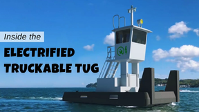
Inside the Electrified Truckable Tug

Tracking Foreign Vessels Working in the U.S. Jones Act Market

Inmarsat Enhances Service to Drive Digitalization
Subscribe for
Maritime Reporter E-News
Maritime Reporter E-News is the maritime industry's largest circulation and most authoritative ENews Service, delivered to your Email five times per week


