Chart Error Led to ATB Grounding in Alaska

An articulated tug and barge (ATB) hit a known underwater rock near Kodiak, Alaska, last year, leading to a grounding that caused $1.4 million in damages, the National Transportation Safety Board (NTSB) said Tuesday.
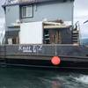
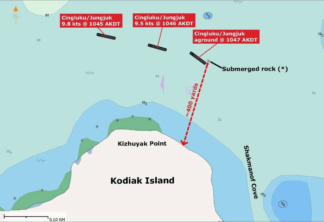
The Brice Marine-owned and -operated tugboat Cingluku and barge Jungjuk were transiting into Shakmanof Cove from Marmot Bay on May 25, 2023, with six crewmembers onboard. The Cingluku and Jungjuk operated together as an ATB, and were primarily used to transport containerized cargo and vehicles. While approaching the entrance to the cove, the barge grounded on a submerged rock, damaging the barge’s steel hull. No pollution or injuries were reported, and there was no damage to the tugboat.
The captain plotted a route into Shakmanof Cove in the vessel’s electronic chart system, or ECS, using the National Oceanic and Atmospheric Administration electronic navigational chart, or ENC, for Marmot Bay and Kupreanof Strait. As the ATB was turning near the entrance of the cove, the barge ran aground on a charted submerged rock that was not detectable on radar or through a visual lookout. Although the rock was charted on the ENC, the captain did not notice the asterisk marking the rock’s location.
The captain did not reference the United States Coast Pilot, which included the rock’s location. Using other available resources would have helped the captain in identifying the rock when planning and reviewing the route, the NTSB said.
The crew also did not use the ECS functions that would have increased their awareness of the rock’s location, including certain grounding avoidance features, nor did the operating company ensure they used or understood these functions.
“Owners and operators should ensure their crews are sufficiently trained in the use of their electronic chart system (ECS) and understand how to use the different functionalities of the ECS,” the report said. “An ECS offers advanced features that can help users increase their vessel’s safety and crew situational awareness of potential safety hazards. In some cases, incorrect, or non-use of these features may even reduce situational awareness to certain hazards, such as submerged rocks.”