Weather Routing: Sofar Ocean Plots the Course
Sofar Ocean is on a quest to extract and put to use data from the world’s waterways. Co-Founder and CEO Tim Janssen discusses how his team’s hyper-focus on data is helping to improve weather routing via Wayfinder.
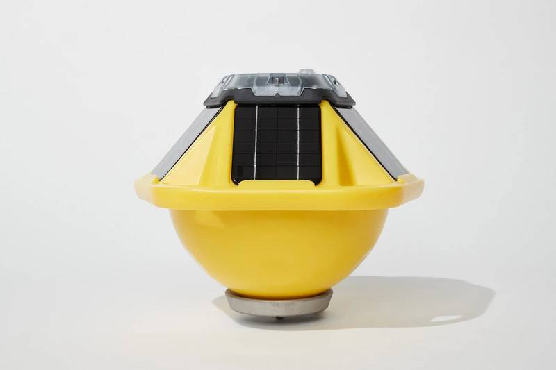
Tim Janssen and his Sofar Ocean team continue their ‘Epic Ocean Data Quest,’ remaining laser focused on doing its part to help extract and put to use increasing quantities of information from the world’s oceans. For its part, Sofar continues to build scalable networks to gather information premised on its Sofar Spotter buoy. Today, Sofar Ocean has more than 2,500 sensors deployed worldwide, an array that provides more than 200,000 daily updates on ocean weather globally, helping forecasters to improve their forecasts by up to 40%.
While Janssen admits that weather models today do a reasonably good job, the key to making them even better lies in the amount and the quality of information being put in. “I think step one is acknowledging that models are only as good as the data you put into it,” he said. “Assuming that the model can do that reasonably well, the way to make them better foundationally is put more information into them; that’s why we are hyper focused on creating large networks of sensors … [the oceans are] a very big place.”
“The principle’s very simple, technically it’s described as data assimilation, which basically means we’re taking all the sensor information we can get our hands on … our own network of thousands of sensors worldwide, satellite data, data from public networks … and we put all of that information into our models on the ‘now’ state. We tell the model, ‘look this is what we know about how the weather is behaving right now, take that, correct whatever you thought was going on, and translate that into what will be happening in the future.’”

Tim Janssen, CEO & Co-Founder, Sofar Ocean, holding one of his ubiquitous Spotter Buoys
“We run our own operational numerical weather forecast models in the cloud, gathering all of this information every six hours, getting everything together, running a forecast cycle, and basically improving the forecast, reducing the uncertainty. From the ground up, the whole system is designed to be a very effective way of reducing uncertainty in forecasts,” said Janssen. “How cool is it that a small team like ours can actually run numerical weather forecasts in the cloud? That’s cloud computing; it wasn’t possible five years ago.”
So melding sensors – sensors low cost enough to allow deployment at scale – with IoT capabilities plus real-time connectivity to drive that information to the models creates a dynamic and powerful value proposition.
- On April 11, 2023, it was announced that Star Bulk (NASDAQ: SBLK) and Eagle Bulk (NYSE: EGLE) fleets will use Sofar Ocean’s Wayfinder voyage optimization platform with the aim of reducing emissions and increasing fleet efficiency. “Star Bulk has been focusing on voyage optimization for several years to minimize our costs and reduce emissions, and we are always on the look-out for new products that use advanced technologies,” said George Mantalos, Energy Efficiency Director at Star Bulk. “What we like about Sofar’s services is that they use a large network of ocean weather sensors to improve the accuracy of weather forecasting. We expect that this should allow us to further optimize our fleet’s routes and speeds.”
- “Eagle Bulk has a track record for leveraging data to make the best decisions,” said Jonathan Dowsett, Director of Fleet Performance at Eagle Bulk. “Sofar Ocean’s real-time sensor-derived ocean data allows our onboard and shoreside teams to dynamically optimize speed and routing decisions with safety, cost, and emissions benefits.”
Wayfinder
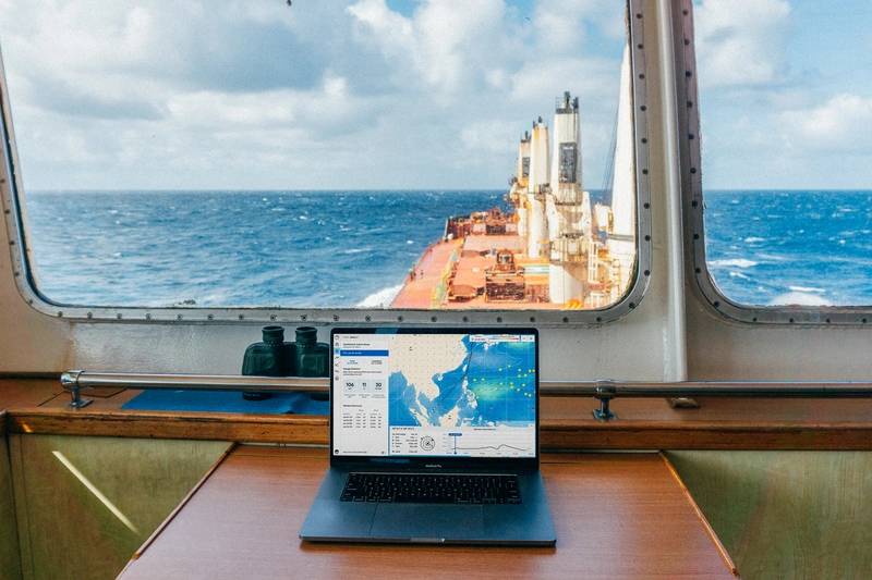
Wayfinder is a dynamic voyage guidance system, designed to deliver the most efficient and least weather-restricted speed and waypoint recommendations to a fleet. Powered by Sofar Ocean’s global network of ocean sensors, helping to produce accurate marine weather forecasts and inform detailed Vessel Performance Models (VPM).
“We built this platform for maritime shipping that’s going to help reduce emissions. It’s going to be tying into new CII regulations, and it’s going to help the industry accelerate its journey towards a more carbon-free future,” said Janssen.
Core to Wayfinder’s capability is the real knowledge of what weather is happening and is forecast to happen at certain spots in the ocean.
While he admits that Sofar Ocean may be late to the game – considering the amount of time, money and effort shipowners have already poured into optimization; from hull design to weather routing, to propulsion technologies and appendages, to coatings – Janssen believes the holy grail of true optimization is still a ways off for many companies. “I think a lot of ship owners have already invested quite big into technologies to improve their vessels without really knowing what it’s going to do for the performance,” said Janssen.
He sees the vessel voyage optimization conundrum as stretching far above and beyond simply knowing the weather, as the factors that go into the decision-making process are complex and dynamic, including the weather, vessel specific performance criteria and market variables too, such as the cost for arriving early or arriving late. By incorporating a vessel’s specific business and safety constraints, Wayfinder continuously provides operators and crew with the most optimized speed and routes possible.
“What we’re trying to do is change the paradigm altogether,” said Janssen. “Every six hours is an opportunity for change. Market variables are volatile, fuel prices go up and down daily, weather changes every three hours. To ‘set it and forget it’ would be a very bad idea if you’re thinking about a transoceanic voyage that could be 30 to 40 days.”
Every six hours, Sofar Ocean runs through its optimizations based on the latest, comprehensive weather data integration, helping to deliver the next strategy. While getting the best data, processing and delivering strategy is the hard part, Janssen said “we solved that problem.” The next challenge is engaging will all partners to both implement, execute and track the strategy to receive tangible results.
“Wayfinder is hyper focused on delivering the best routes and optimization of both waypoint selection and speed. It is optimized to make sure that everybody’s looking at the same information, it is on board and onshore, and basically making sure that there is seamless interaction on the same information and that adherence of the best strategy is maximized,” said Janssen.
Images Courtesy Sofar Ocean


