Remote Inspection: DLS Sends in the Drones
[ to deep, dark & confined spaces ]
DLS Marine received approval from ABS for remote inspection, and it is leveraging advanced drone + software tech to make the process of tank inspection more efficient and less dangerous.
DLS Marine is a long-tenured name in the U.S. maritime survey market, founded by Bob Stickney as Stickney Marine Surveying in New Orleans in 1968, with a pivotal moment coming in 1977 when Stickney hired Norman Dufour, future DLS Marine Partner, as an apprentice marine surveyor. Today, in its 56th year, the company is 40-people strong and continues on the path set more than a half century ago, led by Harry Ward, who became the owner and president of the company in 2017. While the maritime business is generally cast as conservative and slow to change, DLS Marine is at the tip of the spear in one respect: remote survey.
The business of inspecting the structural integrity inside any hull has long been a dirty, dangerous and somewhat arbitrary business. Today, DLS Marine is moving forward fast with an investment in people and digital technology, the latter being state-of-the-art drones and software which helps to not only make the survey process more efficient and more safe; but it makes it more effective, too, providing the owner a better deliverable with more explicit, digitized information on the health of a vessels innards. According to Ward, a pivotal part of the DLS Marine journey into remote inspection via drone was the hiring of Charles Sterling – who previously ran his own consultancy and had done work for DLS Marine – in late 2023.
“Charles had his own consultancy and was doing a lot of work,” said Ward. “He has a really strong IT background, which has become important through this entire process because we're evaluating software, we're helping to write software; so it's more than just flying a drone.”
While the Sterling hire was pivotal, DLS Marine has been investing in and trialing remote survey effectively since Ward took the helm, or as he explains: “Putting a lot out and not getting much back … yet … like any early investment. We've been at this for six-plus years at this point, trying out drone technology and other digital inspection technology, and playing around with different software,” said Ward. “But it's just in the last couple years that those things have started to mature to the point where they're really truly useful and can put out a good product.”
To reiterate, conducting remote survey is more than simply flying a drone. Ward jokes that Sterling is starting to earn the moniker “Maverick” premised on all of the tight spaces he’s able to fly the drones, but the business of remote inspection goes far beyond drone piloting. “The next generation will be more technology-centric. luckily for me I have an IT background so I know CAD, I know AutoCAD and CivilCAD,” said Sterling, DLS' digital inspection director. “To have a good deliverable is to be able to mobilize, capture and attack the job; but sometimes you may have to come back and convert that to a CAD file for a customer,” so while piloting the drone is important, just as critical is the back-end knowledge of the software to control it, as well as the systems to help output the deliverable if needed.

Put to the [Military Sealift Command] Test
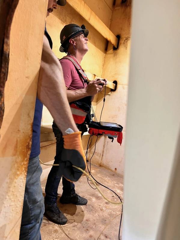
DLS Marine recently completed a tanker inspection job for Military Sealift Command, a confined space inspection of ballast tanks, said Ward. “[Class] was on site and we were able to enter the tanks, which was ‘GPS denied’, meaning that the drone ‘paints’ the entire tank with a LiDAR.”
“We were able to go in, get a LIDAR navigation and point cloud of the entire tank, and give very specific and up close high-resolution digital video and images of the entire tank while the classification team was watching, either inside or outside the tank, however they chose.”
In addition to the LIDAR, the drone carried sensors to measure more than 20 different gases, and the tech is able to provide a deliverable within 1 to 1.3 cm of accuracy plus 4K video, said Sterling. “During the inspection, while we're flying, you can take a [a photo at a particular] point of interest. It puts it into the model, so when you're reviewing it in the portal you can see where that photo was taken in point of interest.”
The class surveyors were in the tank a part of the time, “but it was warm, and with our ability to broadcast it on deck up top, they opted to stay up on top deck after that and watch it on TV. So they viewed it in real time while we were doing [the drone inspection] below deck.”
Important too is the fact that the drone used was tethered for power and control, meaning there was no time limit or additional danger due to the use of lithium-ion batteries.
“With tethered power, there’s no need to stop: if the tank was 100 miles wide, we could fly it for 100 miles,” said Sterling. “We don't have to worry about batteries, which could be an issue in some tanks because lithium-ion is not a stable substance, and can be explosive. So we're going in there with a grounded tether.”
Ultimately, the surveyors received a better deliverable more efficiently, a real-time, high-res data feed that not only can be watched outside of the tank, it can be beamed via the internet anywhere in the world.
“So theoretically at some point, let's say [a class] inspector could be watching this live from [their office] while we're doing the inspection somewhere in the world. It’s exciting technology,” Ward concluded.
Watch the full interview on Maritime Reporter TV:
